Maui (Upcountry)

Maui Vegetative Fuels Management Collaborative Action Planning Workshop

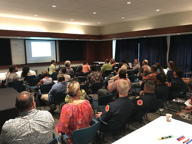
Full house for the workshop!

Full house for the workshop!

As a hub of wildfire protection efforts across the Hawaiian Islands, we are always looking for ways to bring people together to solve some of our most complex wicked problems. The Hawaiian Islands have been struggling with invasive species spread for decades, but now we are seeing what happens when invasive flammable plants take over the landscape and allow fires to spread more quickly and over larger areas. By controlling or managing flammable vegetation at the landscape-level, we can make great strides towards reducing the wildfire risk on our islands.

That’s why HWMO is coordinating a statewide vegetative fuels management mapping project — a rapid assessment to understand the vegetation management needs and priorities of landowners and land managers throughout the Hawaiian Islands. DLNR Division of Forestry and Wildlife and University of Hawaii CTAHR Cooperative Extension are key partners in the effort.

The vision for the project is that the resulting maps will lead to 1) better prioritization and communication of vegetative fuels management on the landscape-scale and 2) enhance project coordination between organizations and funding opportunities.

Marking areas of importance to protect from wildfires.

Marking areas of importance to protect from wildfires.

Discussing collaborative project ideas.

Discussing collaborative project ideas.

As part of the next phase of our groundbreaking project, we held a collaborative action planning workshop at the Maui Arts and Culture Center in Kahului. Nearly 50 participants representing a wide variety of fields and backgrounds came together to discuss what future landscape-level vegetation management projects could be on the horizon. During breakout group sessions, teams of people circulated to different tables to highlight key areas for protection, helping inform us on the top priority areas for the last part of the workshop: outlining actual project ideas. Additionally, and possibly more importantly, many people were able to meet new faces, share ideas, and became new work partners. HWMO truly is a hub!

Maui Vegetative Fuels Management Collaborative Action Planning Meeting 9/27/18

Maui Vegetative Fuels Management Mapping Meetings and LHWRP Workshop

Mapping with Lance De Silva of DOFAW.

Mapping with Lance De Silva of DOFAW.

As a hub of wildfire protection efforts across the Hawaiian Islands, we are always looking for ways to bring people together to solve some of our most complex wicked problems. The Hawaiian Islands have been struggling with invasive species spread for decades, but now we are seeing what happens when invasive flammable plants take over the landscape and allow fires to spread more quickly and over larger areas. By controlling or managing flammable vegetation at the landscape-level, we can make great strides towards reducing the wildfire risk on our islands.

That’s why HWMO is coordinating a statewide vegetative fuels management mapping project — a rapid assessment to understand the vegetation management needs and priorities of landowners and land managers throughout the Hawaiian Islands. DLNR Division of Forestry and Wildlife and University of Hawaii CTAHR Cooperative Extension are key partners in the effort.

The vision for the project is that the resulting maps will lead to 1) better prioritization and communication of vegetative fuels management on the landscape-scale and 2) enhance project coordination between organizations and funding opportunities.

Mapping at the LHWRP office with members of the ranching community on Maui.

Mapping at the LHWRP office with members of the ranching community on Maui.

On June 16 and 17, we had a series of meetings with DOFAW, Alexander & Baldwin, Hana Ranch, and DHHL to map current and desired vegetation management activities in Maui Nui. Activities could include any vegetation reduction or conversion projects such as roadside mowing, fuelbreaks, grazing rotations, clearing around structures or power poles, brush abatement or thinning, tree trimming, loi restoration, agriculture, and native forest restoration. On June 18, we held a workshop in conjunction with Leeward Haleakala Watershed Partnership to gather more data, especially in regards to restoration efforts and grazing areas.

Waiohuli Firewise Community Hazard Assessment

HWMO assisted Waiohuli Hikina with a $5,000 grant from U.S. Forest Service WUI funds to create a fuelbreak between homes and the black wattle forest that is a potential wildfire threat.

Although Upcountry Maui may not typically be known as being at risk of wildfire, more and more wildfires have threatened communities even in areas that might be considered “wet.” The El Niño-caused drought conditions early in 2016 contributed to wildfires across that state that occurred in wetter areas including in Kula. In February, a wildfire burned within the Waiohuli homestead (Kula Hawaiian Homes), prompting residents to take action. In the spring of 2016, HWMO assisted the community with a $5,000 grant from U.S. Forest Service WUI funds. With the project money, the community hired a contractor to create a wide fuelbreak behind nearly a dozen homes along the edge of a wildland area. As a next step, the community is on board for becoming a Firewise Community, joining Launiupoko and Kahikinui on Maui to become the first Maui Firewise Communities.

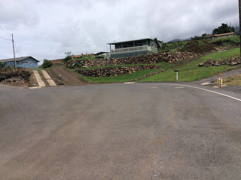
When dry, invasive ivy and other shrubs in Waiohuli can become a wildfire hazard, threatening homes along the gulch, as seen above.

As one of the first steps towards certification, HWMO’s Pablo Beimler met with Lance De Silva of DOFAW to conduct a wildfire hazard assessment for the community. Even though the area looked “green” as they drove around the neighborhood, fire was still on the mind, especially considering how fast the plants there dried out during the El Niño drought. Once HWMO puts a report together of the assessment, the Waiohuli Firewise Committee members will develop an action plan and hold a Ready, Set, Go! Workshop led by HWMO. The workshop would count as their first Firewise Event, putting them in great position to become a Firewise Community as of 2016!

Waiohuli Firewise Community Hazard Assessment 9/15/16

Big Island Wildfire Coordinating Group (BIWCG) Meeting - Aug. 2016

Ed Teixeira, new director of Hawaii County Civil Defense. Photo Credit: West Hawaii Today

Through quarterly meetings with the Big Island Wildfire Coordinating Group (BIWCG, for short), our emergency response agencies keep each other abreast of the latest departmental news, lessons learned, equipment purchases, and upcoming trainings. Through BIWCG, Hawaii County has seen greater collaboration amongst the response agencies.

HWMO is proud to be a long-time member of BIWCG, which met again at the Hawaii County Civil Defense emergency operations center on the morning of August 17th. The meeting was set-up primarily as a meet-and-greet with new Hawaii County Civil Defense director Ed Teixeira, who stepped into the role of newly-retired Chief Darryl Oliveira. Mr. Teixeira was formerly vice director of Hawaii State Civil Defense and offers a wealth of knowledge about emergency response, including with wildfires. 

Much of the meeting was dedicated to a great discussion facilitated by Melissa Kunz, HWMO staff member and PFX Coordination Assistant. Melissa asked each fire expert at the table about their “best practices” for fuelbreak creation. Bottom line: try to make them as wide as you can without creating vulnerabilities (such as incomplete maintenance, not mowing grasses low enough, placing them in the wrong location, etc.)

HWMO’s Community Outreach Coordinator, Pablo Beimler, gave an update on the Firewise Communities progress being made on the Big Island and Maui. We will be conducting assessments in mid-September for Waikoloa (Hawaii Island), Kahikinui (Maui), and Waiohuli HIkina (Maui) and are coordinating with our emergency response partners for assistance during those events. 

Seabury Hall Presentation

Pablo Beimler gives background on Firewise native plants to Seabury Hall students.

A busy week of school outreach kicked off in Maui on Monday, November 16th. HWMO's Pablo Beimler gave a presentation to the 6-12th grade students of Seabury Hall, a coed college-preparatory school in Makawao.

Pablo kept students engaged by firing questions left and right about Hawaii's wildfire issues and prevention and preparedness messages. Students were especially excited about Kaleo the Pueo, stopping to pick up stickers and bookmarks along with "10 Ways to Prepare for Wildfire" brochures at the end. 

Mahalo to Ms. Jacque Peterka and the Seabury Hall staff and students who opened their doors to HWMO with a warm welcome.

Central/Upcountry Maui CWWP Community Meetings

Map of the area covered by the new CWPP.

Wildfires are becoming more and more of a common threat to communities in Central/Upcountry Maui. 

To draw up a brand new CWPP for Central/Upcountry Maui, HWMO held two community meetings, one at the Makawao Community Center and another at the Kula Community Center, to gather input from community members in the same format as the previous CWPP meetings for Northwest Hawaii Island and North Kona.